
Cartography and National Atlases Department announces:
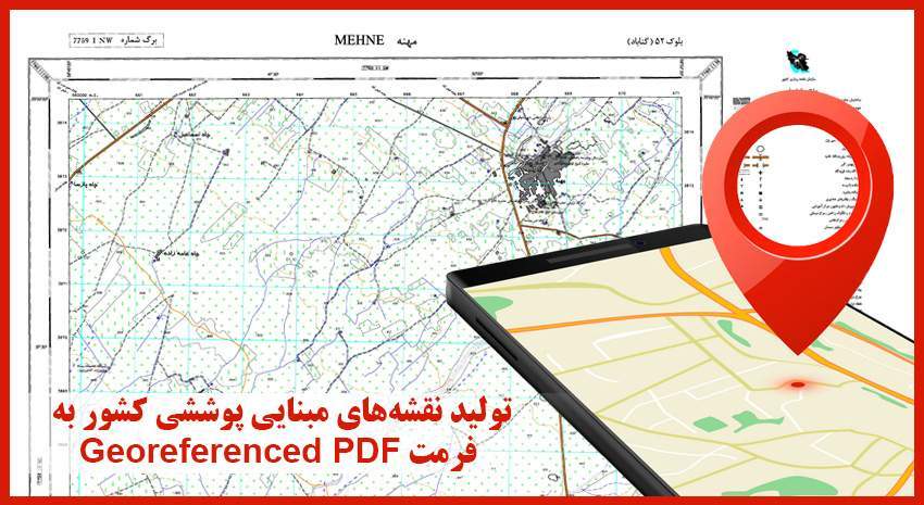
Basic Coverage Maps Production in Geo-referenced PDF Format
The 1۱: 25000 and 1۱: 50,000 Coverage maps of in Georeferenced PDF format are prepared and produced by the Cartography and National Atlases Department of the National Cartographic Center of IRAN (NCC).
According to NCC News, to use digital 1:25000 coverage maps saved as one or more files in DGN format, specialized software such as MicroStation, AutoCAD, or ArcGIS is required. Despite their many capabilities, such software is not available everywhere, and working with them requires special training.
Due to the large volume of spatial information in the country and the tendency of users to use up-to-date products and facilities, the need to use a practical format to display and measure the effects of maps and user-friendly software is felt more than ever.
GeoPDF format or Georeferenced PDF and its display software such as Adobe Acrobat DC are a new and effective solution to this matter. Georeferenced PDF maps are generated while preserving all cartographic elements and features. To have all the information of cartographic maps, these maps are saved as a PDF file with a very small volume and can be considered as a suitable alternative to digital maps with DGN and Shapefile formats.
Using Geo PDF maps on smartphones is one of the benefits of these maps. Software such as Geo PDF Mobile or Avenza Maps can be used to display Geo PDF maps and perform length and area measurements on smartphones.
To place an order and buy Geo PDF maps, refer to the sales system of NCC at https://eshop.ncc.gov.ir.


comment