
It was carried out by National Cartographic Center of Iran:
Installing Sea-Level Monitoring Station in Gorgan Bay Area
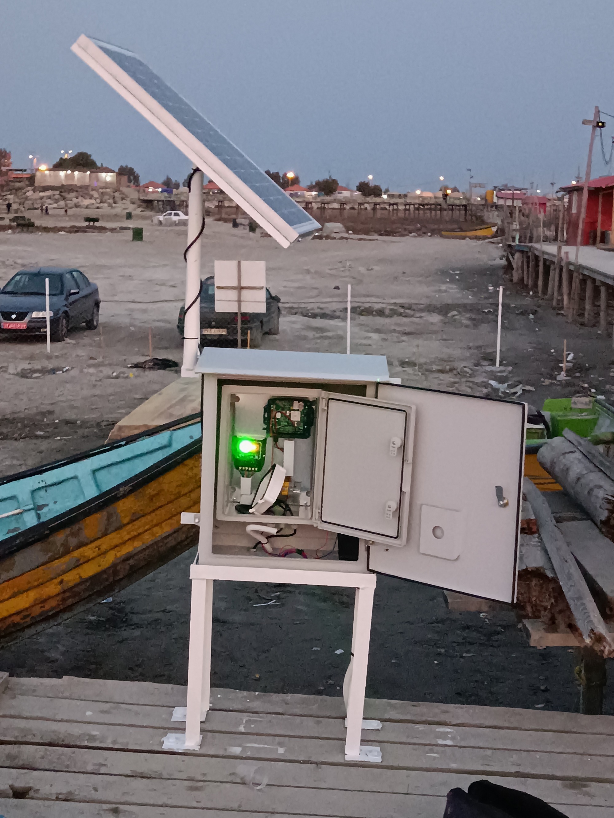
The sea-level gauge station was successfully located and installed in Gorgan Bay, Bandar Turkmen region by experts of Hydrography and Tidal Affairs Department of National Cartographic Center of Iran in January 2023.
According to International Cooperation Office of NCC, the Hydrography and Tidal Affairs Department of this organization announced: “The sea-level gauge station was successfully located and installed in Gorgan Bay, Bandar Turkmen region by experts of Hydrography and Tidal Affairs Department of National Cartographic Center of Iran in January 2023.”
Fazeh Salami, a senior expert in Tidal Affairs, said: “The sea-level gauge station was first installed in this area in 2013, but later due to the drying of part of the Gorgan Bay and of course the drying of the area where the station was located, the location of the station was changed, but with the continued drying process of Gorgan Bay, finally this station was removed in 2015.”
She added: “Considering the climate changes and the lowering of the Caspian Sea level, as well as the receding of the water on the shores of the Gorgan Bay over the past two decades, and following the urgent need for continuous monitoring of sea-level changes, in 2020, National Cartographic Center of Iran cooperated with Ports and Maritime Organization and installed a benchmark around the leveling station of this Organization, which was located in the Ashurade channel between Turkmen port and Ashurade island. Despite the fact that NCC prepared the station for accurate data collection, unfortunately the continuation of sedimentation in this channel and the drying of the water under the tide measuring device, this station was also taken out of use in 2022.”
Salami explained: “The complex of Gorgan Bay and Miankala Peninsula is one of the important environmental areas and one of the vulnerable areas of the country on the southeastern edge of the Caspian Sea. Since one of the important reasons that the Gulf of Gorgan is in crisis is the lowering of the Caspian Sea level, it is necessary to collect the sea level data and make it available to the stakeholders and activists who are studying the restoration and saving of the Gorgan Bay. Therefore, the new station was re-launched with installation of a radar sensor by Hydrography and Tidal Affairs Department with presence and assistance of experts from Management and Planning organization of Golestan province and the General Agency of Ports and Shipping of Golestan province.”
She said: “With installation of this station, the number of sea-level monitoring stations on the shores of the Caspian Sea reached six stations. Other stations are operating in Amirabad, Fereydunkenar, Nowshahr, Anzali and Astara ports. The sea-level monitoring network belonging to NCC in the north and south coasts of the country with 21 stations is the largest and oldest sea-level monitoring network in the country, the information of which is used to monitor and model the sea-level.”
According to Salami, the sea level changes in the Gorgan Bay area will be available online to interested and public users through the sea-level monitoring website at slms.ncc.gov.ir and NCCTIDE application softwar.


comment