
Cartography and National Atlases Department of NCC announces:
Country Rivers and Catchment Basins Services Presentation in National Geoportal
Presentation of the country's rivers and catchment basins services in the National Geoportal were carried out by the Cartography and National Atlases Department of the National Cartographic Center of IRAN.
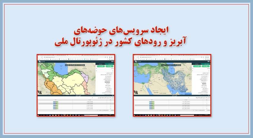
According to the NCC News, the web services of the country's rivers and catchment basins which were produced by the Cartography and National Atlases Department, are presented by the General Department of GIS and SDI.
These web services include the spatial information of the country's catchment basins and rivers network which are as follows:
1- Catchment Basins Web Service: A catchment basin is an area where rainwater runoff is amassed by waterways and directed to an outlet such as a river, reservoir, lagoon, lake or sea. The catchment area of the country includes six super-basins, each of which is divided into small basins and several smaller categories.
These six super-basins are: 1- Caspian Sea catchment 2- Persian Gulf and Oman Sea catchment 3- Urmia Lake catchment 4- Central Plateau catchment 5- Border catchment.
This service includes spatial information of six super-basins of the country and their sub-basins in 6 levels, which has been prepared by the NCC.


comment