
General Department of GIS and SDI of National Cartographic Center of Iran announces:
Participation Growth of Provincial Plan and Budget Organizations in National Geoportal Establishment
With continuous pursuit and efforts of the experts of Department of GIS and SDI, the provinces performance and the rate of their participation in increasing the number of participating bodies in establishment of National Geoportal, Provincial Geoportal, increasing the spatial services provided and completing the needs assessment forms has been very significant.
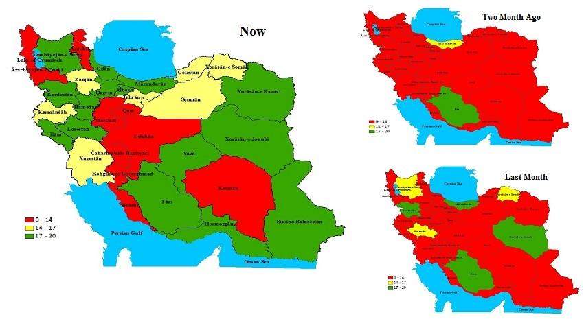
According to NCC’s report, the department of GIS and SDI regarding the implementation and the subsequent participation of 31 provinces in the National Geoportal, made a significant improvement in the performance of the provinces in cooperating to establish the provincial geoportal, increasing the number of shared layers, the participation of the provincial bodies in completing the needs assessment forms, announcing the status quo and the data model.
The increase in provincial performance in the last four months has been considerable and the representative’s efforts and pursuits of each province are important and appreciable.
In the last four months (January 2021, February 2021, March 2021 and April 2021), the increase in provinces' performance separately in spatial services is presented as diagrams as follows:


comment