

In Virtual meeting on World Oceans Day:
National Sea Level Monitoring Network and MSDI Role in Iran’s Maritime Development
A virtual meeting entitled “Iran’s Marine Data and Information in the Service of Maritime Development” was held on the occasion of World Oceans Day with the participation of Hydrography and Tidal Affairs Department of NCC”.

Department of GIS and SDI announces:
First Online Meeting Focusing on SDI Development and Application
The first technical meeting focusing on the development and utilization of SDI was held in the Department of GIS and SDI with the presence of Dr. Madad, general manager of the Department of GIS and SDI, Professor Rajabifard from the Melbourne University, Professor Al-Sheikh from Khajeh Nasir al-din Tusi University, and a group of experts from the General Department of GIS and SDI

The Manager of Hydrography and Tidal Affairs of NCC announces:
Iran participates in IHO Hydrographic Working Group Services and Standards Committee(IHO-HSSC)
Dr. Ali Soltanpour, manager of Hydrography and Tidal Affairs of NCC announced: “The Working Group of the Hydrographic Services and Standards Committee of IHO (IHO-HSSC) started its activities by holding a preliminary meeting on April 29, 2021۱ with participation of the experts from member countries and representatives of specialized companies in this field”.
General Department of GIS and SDI of National Cartographic Center of Iran announces:
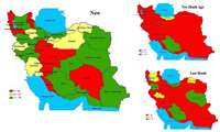
Participation Growth of Provincial Plan and Budget Organizations in National Geoportal Establishment
With continuous pursuit and efforts of the experts of Department of GIS and SDI, the provinces performance and the rate of their participation in increasing the number of participating bodies in establishment of National Geoportal, Provincial Geoportal, increasing the spatial services provided and completing the needs assessment forms has been very significant.

General Department of GIS and SDI announces:
NCC Geoportal Establishment for 27 provinces
Another golden leaf was registered in the record of the General Department of GIS and SDI of National Cartographic Center (NCC) with continuous pursuits and efforts of the experts of the department.
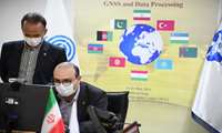
In the 3rd ECO Geomatics Committee Training Course, National Cartographic Center of Iran proposes:
NCC to Establish ECO GNSS Permanent Network and ECO Reference Framework (ECO-RF) for ECO member States
In the 3rd ECO Geomatics Committee Training Course, National Cartographic Center of Iran proposed the establishment of ECO GNSS Permanent Network and ECO Reference Framework (ECO-RF) for ECO member states

Eng. Ghanbarzadeh, General Manager of Director's office, Public and International Relations of NCC, announces:
National Cartographic Center Hosting 3rd ECO Geomatics Committee Training Course on GNSS and Data Processing
Eng. Ghanbarzadeh, General Manager of Director's office, Public and International Relations of NCC, announces: “National Cartographic Center of Iran is hosting the Virtual Training Course on “Reference Frames and Global Navigation Satellite System (GNSS) and Data Processing.”
.jpg)
National Cartographic Center attends UN-GGIM-AP Executive Board Meeting:
IRAN Retention as UN-GGIM-AP EB Member
UN-GGIM-AP Executive Board Meeting was held with the participation of the National Cartographic Center of the Islamic Republic of Iran ,and the membership of NCC was retained in UN-GGIM-AP Executive Board for another year.
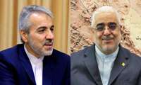
Dr. Nobakht's message of appreciation to Dr. Jafarzadeh Imanabadi on:
National Cartographic Center First Rank in E-Government Development
After achieving the first rank of the National Cartographic Center of IRAN (NCC) in the field of e-government development of Shahid Rajaee Festival and achieving the second rank of the sixth e-services evaluation period; Dr. Nobakht appreciated Dr. Jafarzadeh Imanabadi in a letter.