
Department of GIS and SDI of NCC announces:
Participation Increase in National Geoportal
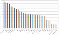
Department of Geospatial Information Systems and Spatial Data Infrastructure (GIS and SDI) of NCC announces the significant increase in Provincial National Geoportal establishment, and its performance growth over the past 3 months
e-Government
Energy Ministry Ready to Conclude MOU with NCC
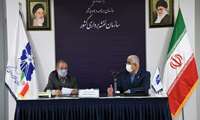
According to the Technical Services Department of NCC, the Ministry of Energy is ready to cooperate and conclude a Memorandum of Understanding (MOU) with NCC

National Cartographic Center Defence of Persian Gulf Name at United Nations
National Cartographic Center of IRAN (NCC) strongly defended the name of the Persian Gulf in a meeting at the United Nations Group of Experts on Geographical Names (UNGEGN), virtually held in New York from May 3-7, 2021۱.
The Hydrography and Tidal Affairs Department announces:
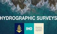
National Cartographic Center Effective Presence in International Hydrographic Organization Working Group
By membership of the representative of NCC in the Hydrography working group of IHO (IHO_ HSWG), the Islamic Republic of Iran will have a more effective presence in IHO
Hydrography and Tidal Affairs Department announces:
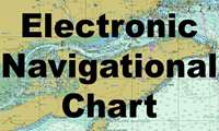
Over 64000 Electronic Navigational Charts Sales in 2020
Electronic Navigational Charts of the country's waters produced by the National Cartographic Center of Iran have been replaced with foreign charts which play a major role in ensuring maritime safety based on global requirements.
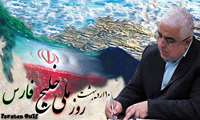
Dr. Jafarzadeh Imanabadi, the Director General of NCC on the national day of the Persian Gulf:
Persian Gulf, Symbol of Ancient Iranian History, Culture, Civilization; Vital Artery of Economic Exchange in Middle East
Dr. Jafarzadeh Imanabadi, the Director General of NCC conveyed a message to the presidents of the International Associations on the national day of the Persian Gulf.

Congratulatory message of Dr. Jafarzadeh Imanabadi, Director General of NCC on Earth Day
Dr. Jafarzadeh Imanabadi, Director General of National Cartographic Center of Iran (NCC) conveys a congratulatory message to the presidents of the International Surveying Associations on Earth Day
Message of the Director General of NCC, Dr. Jafarzadeh Imanabadi to the Senior National and Military Officials on the Occasion o
Dr. Jafarzadeh Imanabadi, the Director General of NCC conveys a congratulatory message to the senior national and military officials on the occasion of the beginning of the Persian New Year(Nowruz)
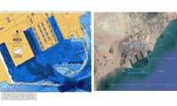
Hydrography and Tidal Affairs Department of National Cartographic Center of Iran announces:
Shahid Rajaee Port Berthing Chart Production
The berthing chart of Shahid Rajaee Port, the largest commercial port of Iran, which plays a major role in the country's commercial development, is produced by National Cartographic Center.
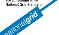
The Standardization Group of NCC announced:
The 8th volume of the National Grid Standard is published by NCC
The 8th volume of the National Grid Standard, from the series of Unified Surveying Instructions is published by National Cartographic Center of Iran (NCC)