
The National Cartographic Center of the Islamic Republic of Iran in cooperation of ECO secretariat announces:
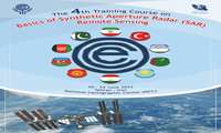
4th International Specialized Training Course on “Basics of Synthetic Aperture Radar (SAR) , Remote Sensing” for ECO Member States
The National Cartographic Center of the Islamic Republic of Iran, in cooperation with ECO secretariat, holds the 4th international specialized training course on” Basics of Synthetic Aperture Radar (SAR), Remote Sensing” virtually with the participation of ECO member states .
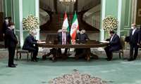
Valuable international achievement for the National Cartographic Center of the Islamic Republic of Iran (NCC):
In Presence of Iran and Tajikistan Presidents, MOU Between NCC and State Committee of Land Management and Geodesy of Republic of Tajikistan is Signed
The memorandum of understanding(MOU) between the National Cartographic Center of Islamic Republic of Iran(NCC) and the State Committee of Land Management and Geodesy of the Republic of Tajikistan began with the presence of NCC in the meetings of the Joint Economic Commission of the Islamic Republic of Iran and the Republic of Tajikistan at the Ministry of Energy.After the presence of NCC in the last meeting of the Joint Economic Commission of the Islamic Republic of Iran and the Republic of Tajikistan, NCC proposed the export of engineering technical services in spatial information and geomatics field to Tajikistan, which was warmly welcomed by Tajikistan.
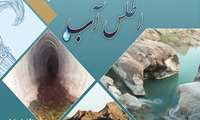
Introducing Water Atlas; created by National Cartographic Center of Iran
The Water Atlas was created by National Cartographic Center of Iran.

Dr. Mirkazemi, Vice President and Head of Plan and Budget Organization:
Countering History Distortion and Fake Words Use On Persian Gulf Ought to be On Permanent Agenda of National Cartographic Center/ NCC Plays Significant Role in Provincial Planning and Seventh Development Plan
Vice President and Head of Plan and Budget Organization, on April 30, coinciding with the commemoration of Persian Gulf National Day and unveiling National Water Atlas created by National Cartographic Center said that Countering History Distortion and Fake Words Use particularly on the Persian Gulf Ought to be on the Permanent Agenda of National Cartographic Center/ NCC Plays a Significant Role in Provincial Planning and Seventh Development Plan.
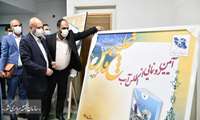
On Persian Gulf National Day:
Dr. Mirkazemi, Vice President and Head of Plan and Budget Organization Unveils National Water Atlas Produced by National Cartographic Center
On the occasion of the Persian Gulf National Day, Dr. Mirkazemi, Vice President and Head of Plan and Budget Organization of the Islamic Republic of Iran, unveiled the National Water Atlas by attending the National Cartographic Center.
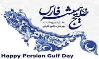
National Cartographic Center of Iran commemorates:
Persian Gulf National Day
The National Cartographic Center of Iran commemorates the arrival of the National Persian Gulf Day, which falls on Ordibehesht 1۱0 (April 30).

Another service from National Cartographic Center of Iran:
Ease of Quick Access to Digital Version of NCC Products
In another service provided by National Cartographic Center of Iran, ease of quick access to the digital version of NCC Products is enabled for the applicants.

21۱ March, the International Day of Nowruz
Nowruz, Celebration of Spring Arrival and New Year in IRAN
March 21۱ is the first day of spring. But for about 300 million people around the world, it’s the beginning of a new year, too. Nowruz, which means “new day”, is a holiday marking the arrival of spring and the first day of the year in Iran, whose solar calendar begins with the vernal equinox.
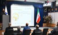
Director General of National Cartographic Center of IRAN, at the opening ceremony of the 26th National Conference and Exhibition
To Build Synergy Among Experts in Mapping and Spatial Data and to Provide its Services to Users, Including Knowledge-Based companies, Universities are of Conferecne Important Goals
Dr. Ali Javidaneh, Director General of National Cartographic Center of IRAN, at the opening ceremony of the 26th National Conference and Exhibition of Surveying and Spatial Information announced that build Synergy Among Experts in Mapping and Spatial Data and to Provide its Services to Users, Including Knowledge-Based companies, Universities are of Conference Important Goals

Message from Dr. Mirkazemi, Vice President and Head of Plan and Budget Organization of the Islamic Republic of Iran at the Openi
Plan and Budget Organization and National Cartographic Center with Heavy Responsibility of Policy-making, Leadership, Coordination, Budgeting and Management For All Fields of Surveying Engineering in Iran
Dr. Mirkazemi, Vice President and Head of Plan and Budget Organization of the Islamic Republic of Iran, in a message on the occasion of the 26th National Conference and Exhibition of Surveying Engineering and Spatial Information said: “Plan and Budget Organization of the Islamic Republic of Iran and National Cartographic Center of Iran have a heavy responsibility of policy-making, leadership, coordination, budgeting and management of all fields of surveying engineering in the country by defining the vision of the field”.


