
National Cartographic Center of IRAN (NCC) is holding the largest national event in the surveying and spatial information’s fiel
26th National Conference and Exhibition of Surveying Engineering and Spatial Information; Geomatics 1۱400
The National Cartographic Center of IRAN (NCC) is holding the 26th National Conference on Surveying Engineering and Spatial Information, which is the largest national event in surveying and spatial information, with the motto "Spatial information; the country's economic development Infrastructure"
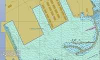
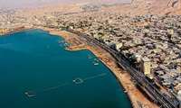
The Hydrography and Tidal Affairs Department announces:
International Publication of First Berthing Chart
Shahid Rajaee Port Berthing Chart was internationally published.
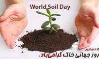
National Cartographic Center Message on December 5, World Soil Day
On the occasion of December 5, World Soil Day, the National Cartographic Center of IRAN (NCC) celebrated this day.
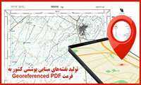
Cartography and National Atlases Department announces:
Basic Coverage Maps Production in Geo-referenced PDF Format
The 1۱: 25000 and 1۱: 50,000 Coverage maps of in Georeferenced PDF format are prepared and produced by the Cartography and National Atlases Department of the National Cartographic Center of IRAN (NCC).
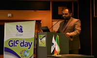
Acting Director General of NCC in GIS Day:
Spatial Information Necessary for National Plans Implementation and Macro-Planning
At the GIS Day meeting, Dr. Ali Javidaneh, Acting Director General of NCC, said that Maps and spatial information are necessary for the implementation of national plans and macro-planning of the country
National Cartographic Center of Iran announces:
Sea Level Monitoring Network and Tsunami Warning System Development in Strategic Makran Region
National Cartographic Center of Iran announces the Development of Sea Level Monitoring Network and Tsunami Warning System in Strategic Makran Region.
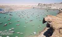
With the progress made in launching the vessels of the National Cartographic Center of IRAN, Hydrography and tidal affairs depar
New Season in IRAN Coastal Hydrographic Activities
By increasing the power of NCC’s navy, coastal Hydrography is on the path of further growth. To this end, the operation of preparing and launching the organization's vessels under the supervision of the Hydrography and Tidal Affairs Department is currently underway.
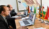
At the 3rd ECO Geomatics Committee Meeting:
IRAN-NCC Re-election as ECO Geomatics Committee Secretary
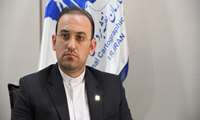
At the 3rd ECO Geomatics Committee Meeting, Dr. Ali Soltanpour, manager of Hydrography and Tidal Affairs of NCC, was elected as the Secretary of ECO Geomatics Committee
National Cartographic Center of Iran in the international arena:
Eng. Ghanbarzadeh: National Cartographic Center Hosts 3rd ECO Geomatics Committee Meeting
Following fruitful activities of National Cartographic Center of Iran in the international arena; Eng. Ghanbarzadeh, General Manager of Director's office, Public and International Relations of NCC, announced the holding of the 3rd ECO Geomatics Committee Meeting virtually with the participation of ECO member states on October 1۱8, 2021۱.
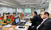
Technical Deputy of NCC in the 3rd ECO Geomatics Committee:
National Cartographic Center of IRAN Ready to Cooperate in Geomatics Fields with ECO Member States
NCC is ready to cooperate with the member countries of the ECO in all fields of geomatics," Baktash said in his national report, introducing all parts of the NCC and their most important activities.


