

Message from Dr. Mirkazemi, Vice President and Head of Plan and Budget Organization of the Islamic Republic of Iran at the Openi
Plan and Budget Organization and National Cartographic Center Have Heavy Responsibility of Policy-making, Leadership, Coordination, Budgeting and Management For All Fields of Surveying Engineering in Iran
Dr. Mirkazemi, Vice President and Head of Plan and Budget Organization of the Islamic Republic of Iran, in a message on the occasion of the 26th National Conference and Exhibition of Surveying Engineering and Spatial Information said: “Plan and Budget Organization of the Islamic Republic of Iran and National Cartographic Center of Iran have a heavy responsibility of policy-making, leadership, coordination, budgeting and management of all fields of surveying engineering in the country by defining the vision of the field”.

Dr. Ali Javidaneh, Director General of National Cartographic Center of IRAN announces:
Twenty-sixth National Conference and Exhibition of Surveying Engineering and Spatial Information; Geomatics 1۱400 is a platform to introduce the latest capabilities and achievements in the field of surveying in the country
On the verge of the 1۱400 National Geomatics Conference and Exhibition, Dr. Ali Javidaneh, Director General of NCC said: "The 26th National Conference and Exhibition of Surveying Engineering and Spatial Information; "Geomatics 1۱400 is a platform to introduce the latest capabilities and achievements in the field of surveying in the country."
National Cartographic Center of Iran holds:
Twenty-sixth National Conference and Exhibition of Surveying Engineering and Spatial Information; Geomatics 1۱400 / holding the opening ceremony in webinar form
National Cartographic Center of Iran in cooperation with the Iranian Society of Surveying Engineers and the Iranian Society for Surveying and Geomatics Engineering holds the 26th National Conference and Exhibition of Surveying Engineering and Spatial Information; Geomatics 1۱400 with the slogan "Spatial information, the basis of economic development of the country" on February 22 and 23, 2022 in webinar form.
National Cartographic Center of Iran announces:
20% Increase in International Sales of Nautical Charts in First Six Months of 2022
National cartographic center of Iran announces the 20% Increase in International Sales of Nautical Charts in the First Six Months of 2022
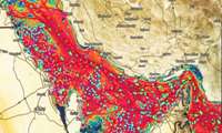
The General Department of GIS and SDI announces the Economic Atlas Study of the country’s 1۱0 provinces
Joint Cooperation Continuation between NCC and Organization for Investment, Economic and Technical Assistance of Iran to Produce National Economic Atlas
The third specialized meeting in order to prepare a national economic atlas was held with the participation of representatives of both organizations (the department of GIS and SDI of NCC and Organization for Investment, Economic and Technical Assistance of Iran) with the participation of 1۱0 provinces representatives.
In order to export the technical and engineering services of NCC to other countries:
NCC Holds First Meeting with Azercosmos of Azerbaijan to Evaluate Capabilities and Find Cooperation Fields
National cartographic center of Iran in cooperation with the Secretariat of the Economic Cooperation Organization (ECO) held:
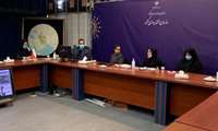
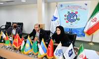
International Specialized Training Course for ECO Member States for 3 Intensive Days
International specialized training course for ECO member states on “Basics of Synthetic Aperture Radar(SAR), Remote Sensing” was held for three days, in the form of a webinar in English by the International Relations Office of NCC and ECO secretariat in cooperation with the General Department of Aerial and Spatial Surveying of NCC.
In order to implement the MOU between the SCLMG of the Republic of Tajikistan and NCC of Iran, the meeting was held on:
MOU Needs Analysis to Evaluate Spatial Information Technical Priorities of State Committee for Land Management and Geodesy of the Republic of Tajikistan
According to the NCC report, quoted from the international relations office of NCC, in order to implement the MOU between the State Committee for Land Management and Geodesy of the Republic of Tajikistan and National Cartographic Center of Iran, the Meeting of MOU needs assessment was held to evaluate spatial information technical priorities.

Dr. Mirkazemi, after holding a specialized training course for ECO member states by NCC, expressed his gratitude for the actions
International Communication Improves NCC Quality Level
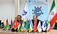
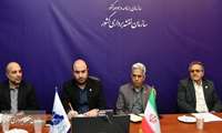
At the opening of the fourth international specialized training course of the ECO Geomatics Committee, Director General of NCC s
National Cartographic Center Fully Prepared to Export Geospatial Engineering Services to ECO Member States
Dr. Ali Javidaneh, Director General of National Cartographic Center of the Islamic Republic of Iran at the opening of the fourth international specialized training course of the ECO Geomatics Committee said that Iran has localized the knowledge of Geomatics and spatial information and now is self-sufficient in meeting the country’s needs and ready to export our innovative technology and engineering services to all ECO member states.


